
East Tennessee State University researchers are helping uncover a largely hidden chapter of American history through a groundbreaking project in the Adirondack Mountains of New York.
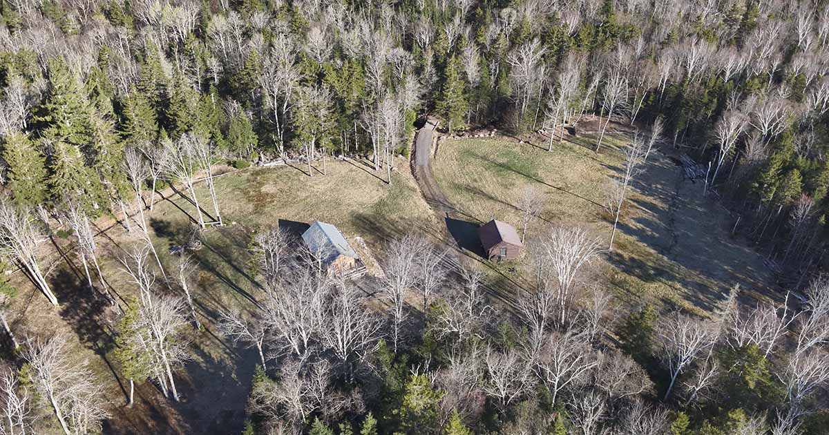
Earlier this year, ETSU geosciences faculty members Dr. Eileen G. Ernenwein and Steven Jones partnered with researchers from State University of New York at Potsdam and historians from the Adirondack Experience museum to use advanced LiDAR technology in search of evidence tied to Timbuctoo, a mid-1800s settlement established for free Black Americans near present-day Lake Placid.
The project combines cutting-edge remote sensing technology with historical and archaeological research to locate traces of homes, roads, farms and other signs of life that have long been reclaimed by dense Adirondack forests.
Using a drone equipped with Light Detection and Ranging (LiDAR) technology, the ETSU team surveyed roughly 200 acres of rugged woodland believed to have once been occupied by Timbuctoo settlers. The drone collected millions of data points to create detailed three-dimensional models of the forest floor, allowing researchers to identify subtle landscape features invisible to the naked eye.
The most significant moments of the weeklong survey came not from the drone data, but from the people who walked the land alongside the researchers. Descendants of Timbuctoo settlers visited the site during the fieldwork, standing on ground their ancestors cleared and farmed nearly two centuries ago. For many, seeing the LiDAR imagery resolve faint depressions and stone lines into the possible outline of a home or field boundary made something long abstract suddenly tangible. Their presence grounded the research in its deepest purpose: not simply recovering a lost settlement, but honoring the people who built it.
“This project demonstrates how modern geospatial technology can help recover stories that history has nearly erased,” said Ernenwein, associate professor in ETSU’s Department of Geosciences. “What makes this work especially meaningful is that we are not simply mapping terrain. We are helping uncover evidence of lives, communities and resilience that deserve to be remembered and better understood.”
Dr. Lindsey Cochran, assistant professor in ETSU’s Department of Anthropology and winner of the prestigious Society for Historical Archaeology’s 2026 Mark E. Mack Community Engagement Award for community-informed heritage preservation research, also serves as a co-principal investigator on the project and is developing a GIS model of the historic Timbuctoo settlement.
The work builds on more than 15 years of research led by SUNY Potsdam anthropology and archaeology professor Dr. Hadley Kruczek-Aaron. Early LiDAR findings have already identified several areas that may contain remnants of field systems, stone piles or building foundations connected to the settlement.
A film crew documented the weeklong research effort for a new exhibit being developed to open in summer 2027 at The Adirondack Experience, The Museum on Blue Mountain Lake.
For ETSU, the collaboration reflects the university’s growing national reputation in applied geospatial research and interdisciplinary scholarship.
"Our faculty are competing at a national level, building partnerships with major research institutions and museums, and producing scholarship that genuinely matters,” said Dr. Joe Bidwell, dean of ETSU's College of Arts and Sciences.
Learn about ETSU faculty and pushing the status quo at etsu.edu/trailblazers.

.jpg)
.jpg)